Seconded By: Britta Jaschinski,
This project chronicles a city and its fringes on the cusp of a watershed moment.
Most modern Southeast Asian cities aspired to resemble Western cities, visually characterised by skyscraper-dense horizons and superhighways.
While Greater Kuala Lumpur is no exception to the rule, it stands out in one remarkable area—it is surrounded by significant tropical rainforests. These rainforests are an ecological linchpin, regulating temperatures, mitigating floods, and purifying water, collectively buffering the city against climate change.
This delicate balance shifted in the mid-1980s as Greater Kuala Lumpur reached an inflection point in its growth. The government-driven car industry and the city’s car-centric design led to the development of highways within and beyond the metropolitan area. This led to a cycle of forest fragmentation and city expansion, rapidly increasing its urban footprint. By 2024, Greater Kuala Lumpur had grown more than 6 times its size in 1974, with its population surging nearly 15-fold to almost 9 million. However, due to its significantly smaller population than its regional peers – sprawling megacities such as Jakarta, Bangkok, and Manila – its rapid expansion is comparably slower, and its forests, although assaulted, for now, continue to survive.
Despite this slower pace, the environmental costs of expansion have been profound. With increasingly unpredictable rainfall driven by escalating climate change and diminished forests that would otherwise absorb the excess runoff, Greater Kuala Lumpur now faces floods and landslides with increasing severity and frequency, occasionally leading to loss of lives. Moreover, the proliferation of superhighways—built to connect hubs of commerce, industry, and entertainment—fragments forests and the communities they traverse. The overreliance on cars has led to more vehicles than the population of Malaysia in 2024.
The pattern of rampant deforestation and unchecked city growth had helped prosper the capital of a young nation at a time when its abundant rainforests and resources seemed inexhaustible. Although significantly diminished, Greater Kuala Lumpur may yet pivot and preserve the invaluable natural wealth that sets it apart from most cities. Achieving this, however, would demand a seismic shift in the mindset of the Malaysian public. The forest must be seen not as an endless supply of resources to be exploited or razed when inconvenient, but as an indispensable entity to be safeguarded, for its intrinsic value and the city’s long-term survival.
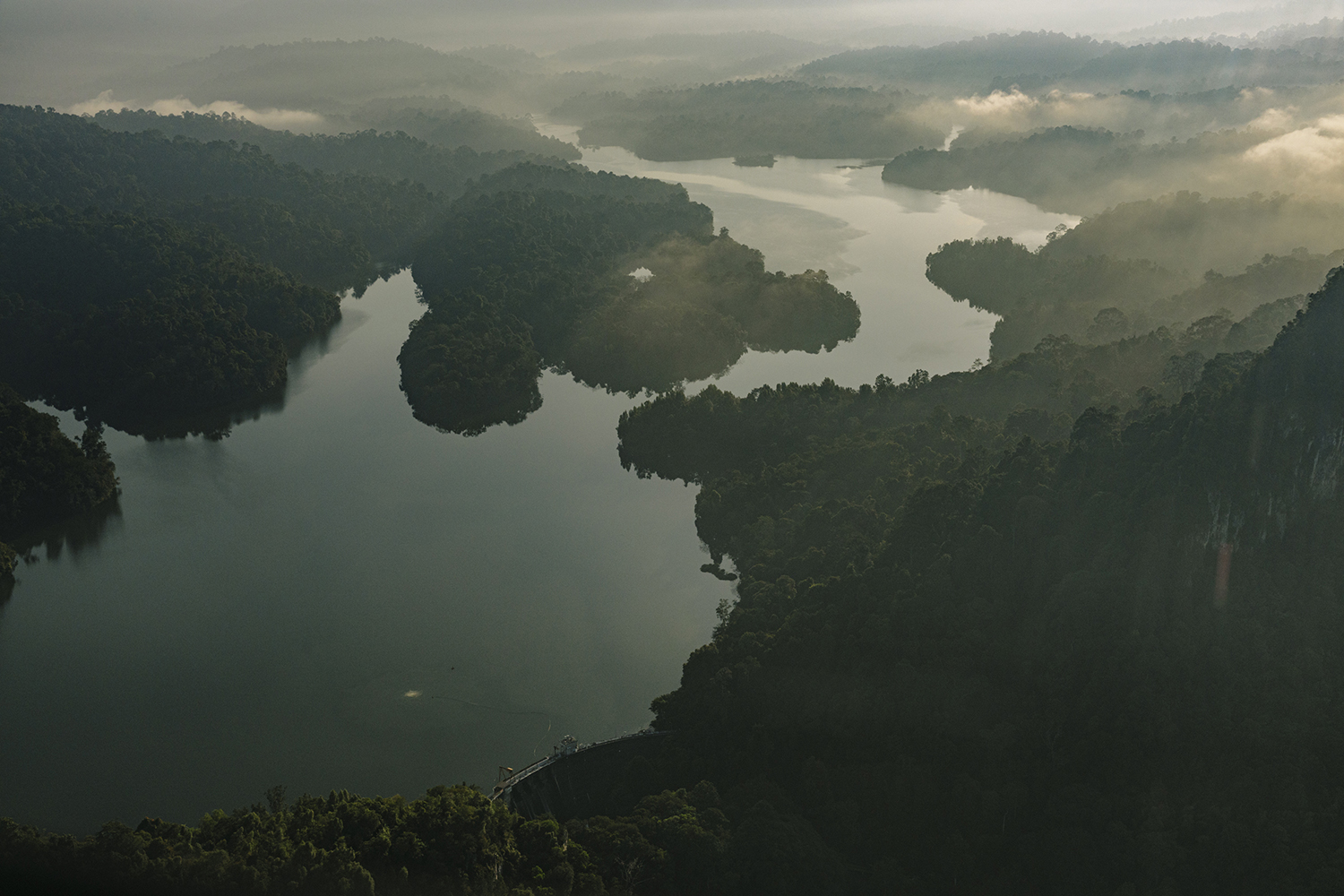
The Klang Gates Dam
Completed in 1958, the Klang Gates Dam was the first dam built in Malaysia for water supply, and it doubles as a flood mitigation dam.
The dam is fed by the rivers that flow through the surrounding forests. It is part of a large contiguous forest that covers the Malaysian Peninsula’s central mountain range. As the primary drinking water source for parts of the city, the forest faces significant threats from development and land clearing.
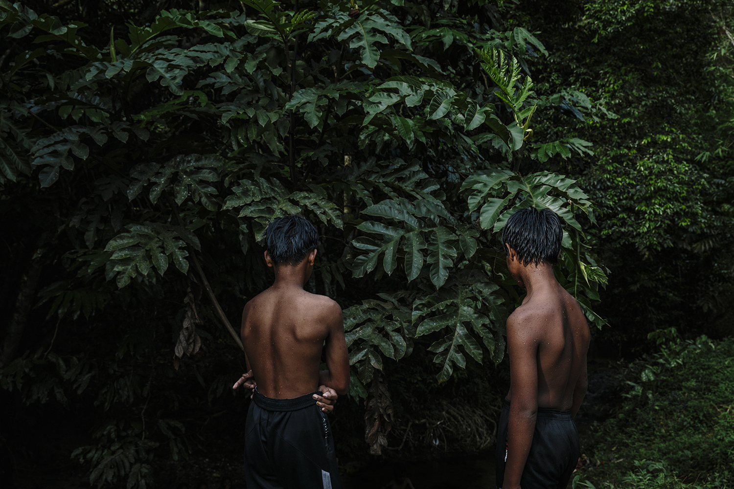
Two Indigenous Boys
Two indigenous boys are playing near a river in Kampung Orang Asli Kuang. The village is likely to be negatively affected, and its residents may need to relocate due to the allocation of more forest reserve land for quarrying activities. Across the region, quarries have significantly scarred the landscape, particularly impacting the Bukit Lagong Forest Reserve, an area designated as Highly Environmentally Sensitive.
The state approved nineteen new quarry licenses to replace older quarries. This decision represents 23% of the forest reserve, amounting to 800 hectares of intact primary forest designated as a “sacrifice zone” for quarrying. The approval is intended to meet the demand for building materials required for development in Greater Kuala Lumpur and the state of Selangor. Ironically, these regions currently have the highest number of unsold properties in Malaysia.
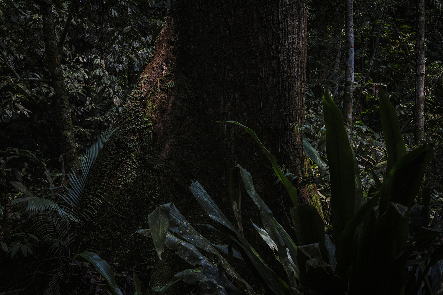
A Dipterocarp Tree
This large tree stands amidst tropical foliage in one of the few remaining patches of primary forest on the edge of Greater Kuala Lumpur. In these rainforests, trees often feature trunks over 1 meter in diameter.
Efforts to protect the forests are a losing tug-of-war between demand and conservation; in the city, they mainly persist on hills and wetlands—terrain that was harder to develop in the past.

A Family Outing at a Waterfall
The Chung family on a family outing in Jeram Kubang Gajah, also affectionately nicknamed Sofea Jane waterfall after the Malaysian actress who was filmed here. The waterfall is only a 20-minute drive from the iconic Twin Towers in the centre of Greater Kuala Lumpur.
Only a few kilometres away, the forest reserve where the waterfall is located is encroached upon by a new luxury residential development and fragmented by a new highway construction.
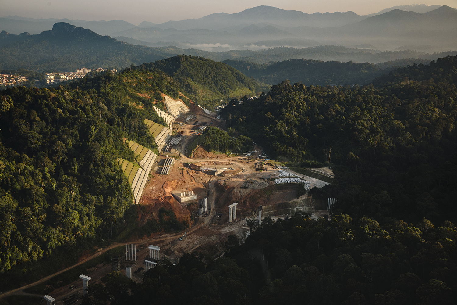
A Highway Interchange in a Forest Reserve
The expressway under construction passes through the Ulu Gombak and Ampang forest reserves. These forests are vital for biodiversity and provide essential ecological services, such as carbon sequestration and heat sinks. They also absorb significant amounts of rainfall, which is crucial for the city’s water supply and helps prevent floods in urban areas downstream.
Deforestation and construction work may have damaged the natural hydrology, with nearby villagers reporting increasing severity of floods and property damage.
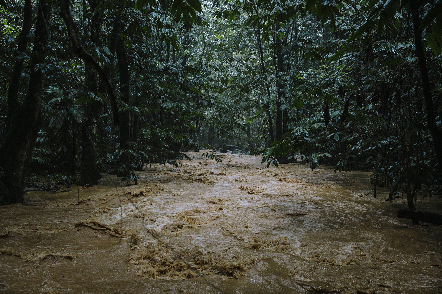
A River Bursts its Banks
A usually pristine tributary—part of the Klang River basin—bursts its banks and turns turbid brown from soil erosion after heavy rainfall due to forest clearing upstream for utility services.
Although the deforestation occurred over a year ago, the area has not recovered. The loss of stabilising vegetation left the topsoil vulnerable to erosion by rainwater and wind. Minerals and heavy metals may leach from the exposed soil and impact the dam’s water quality.
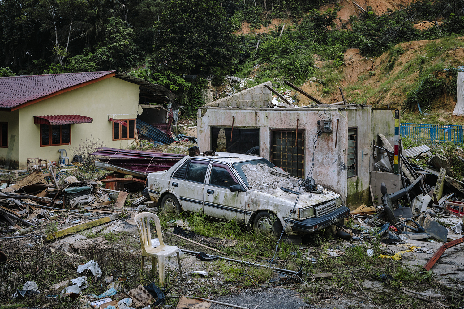
A Flood Damaged Village in the City
Kampung Palimbayan is a small Malay village in Kuala Lumpur. Heavy rains, leading to floods and landslides, have damaged several homes within the village. Floods have become increasingly severe in recent years, with weather exacerbated by climate change. The southwest monsoon’s strong winds and heavy rainfall sometimes devastate Klang Valley’s low-lying areas, causing property damage, business disruptions, and occasional loss of lives.
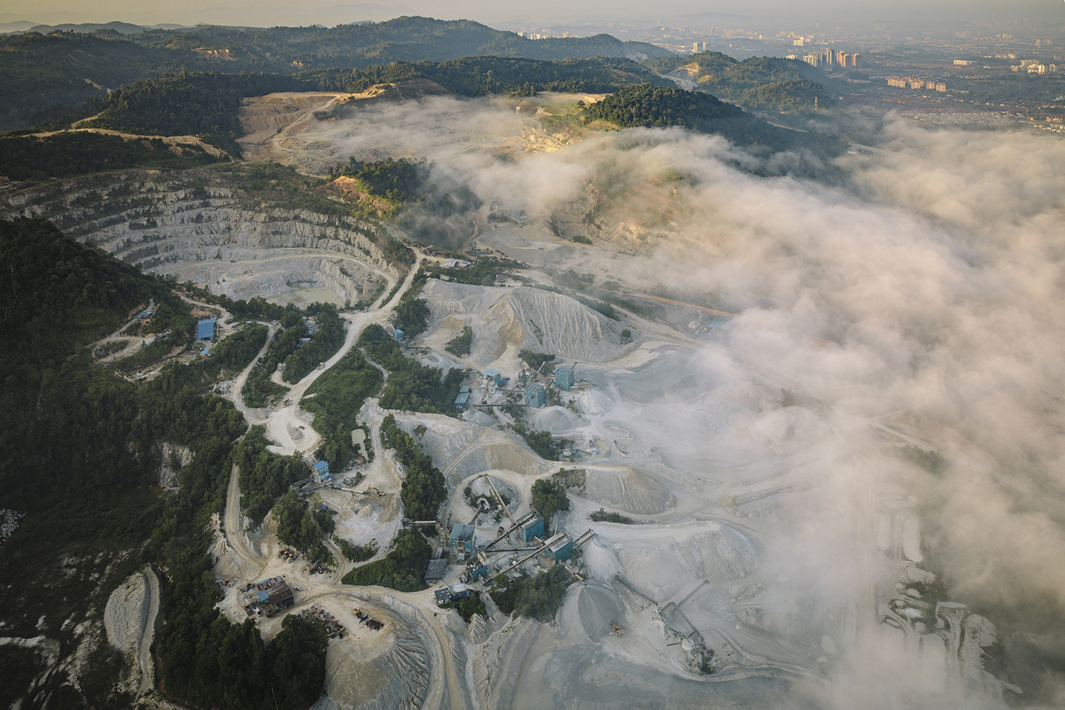
A Quarry on the City's Edge
Hanson Quarry, on the eastern edge of the forested hills of Greater Kuala Lumpur. It is situated in forests that are part of the Central Forest Spine, which extends nearly the entire length of the Malaysian Peninsula. Due to increased demand, new parcels of land in nearby forests have been allocated for quarrying. The company is the largest producer of aggregates and asphalt nationwide.
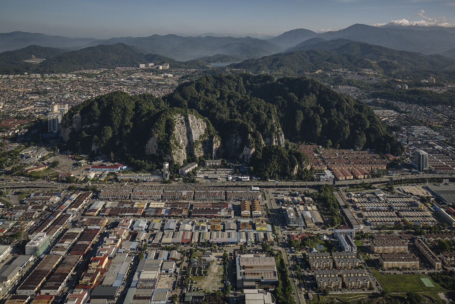
Batu Caves and the Expanding City
The limestone karst of Batu Caves is internationally renowned for its cultural significance and unique biodiversity.
Poor urban planning and a lack of buffer zones threaten this protected ecological site and its delicate ecosystem. As a result, species of plants and animals endemic to the area have been lost.
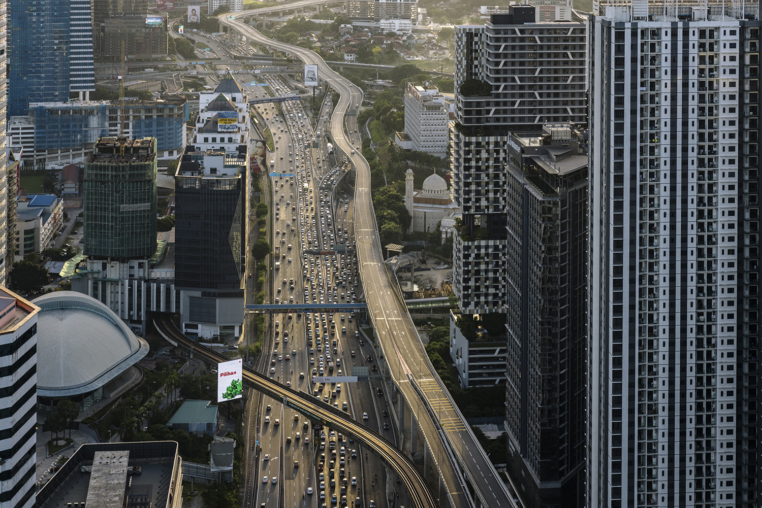
The Federal Highway and the City
The Federal Highway, built in 1959, was once a modest dual-carriageway highway—one of the earliest in the country. It is now 10 lanes wide in some sections, abutting the newest elevated expressway and high-rise buildings on either side. Today, Malaysia has more cars owned per capita, with the country approaching two vehicles per head by 2024, a number unrivalled among developing countries.